


Planit
Photo Planner

Descrizione di Planit: Photo Planner
In questa versione gratuita, la funzione Effemeridi viene fornita come acquisto in-app. Dopo l'acquisto, avrà le stesse funzioni di PlanIt Pro a pagamento.
Si prega di scrivere un e-mail a info@planitphoto.com per segnalazioni di bug o richieste di funzionalità. Ricorda anche di visitare https://youtu.be/JFpSi1u0-is per ulteriori tutorial video. Ogni video dura solo pochi minuti, ma sicuramente imparerai molto. Puoi anche raggiungerci tramite Instagram o Facebook. I collegamenti si trovano nel menu all'interno dell'app.
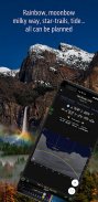
Questa è un'applicazione dedicata ai fotografi di paesaggio e di viaggio, ai fotografi naturalisti e a coloro che sono interessati alla fotografia notturna, alla fotografia di città, ai time-lapse, alla Via Lattea o all'astrofotografia: non cercare altro, questa è l'app definitiva - Planit Pro. Ti costa quanto una buona birra, ma ti farà risparmiare moltissimo tempo e fatica e risparmierai un sacco di soldi per la benzina dato che non dovrai ritornare tante volte sul posto. Inoltre ti farà apprezzare ancora di più la fotografia di paesaggio.
Ansel Adams ha dedicato l'inizio del suo primo libro"Taos Pueblo" alla visualizzazione. Ha introdotto per primo l'idea di"previsualizzazione", che permette al fotografo di immaginare la sua stampa finale, ancora prima di scattare la foto. Certo, esistono anche molte fantastiche foto che sono state scattate improvvisando. Tuttavia, per i fotografi di paesaggio, essere in grado di previsualizzare la scena ancora prima di andare sul posto ridurrà notevolmente la possibilità di essere colti impreparati e aumenterà notevolmente la possibilità di ottenere scatti migliori.
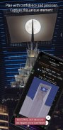
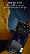
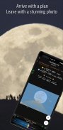
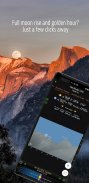
I fotografi usano vari strumenti per riuscire a pre-visualizzare la scena. Al giorno d'oggi, molti di questi strumenti sono app per smartphone. Planit Pro è una soluzione all-in-one, progettata per sfruttare la mappa e simulare il mirino della fotocamera, fornire tutti gli strumenti necessari ai fotografi, per permettere di pre-visualizzare la scena in combinazione con la conformazione del terreno e gli oggetti celesti come il Sole, la Luna, le stelle, le costellazioni e la via lattea.
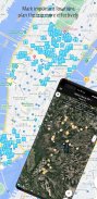
Nell'app Planit Pro, abbiamo condensato tutto ciò che serve - dallo scouting della posizione con coordinate GPS, le elevazioni, la distanza, il dislivello, la visibilità, la lunghezza focale, la profondità di campo (DoF), la distanza iperfocale, la fotografia panoramica e aerea, fino alle Funzioni inerenti le effemeridi come l'alba, il tramonto, il sorgere della luna, l' ora e la direzione dell'alba e del tramonto, l'ora del crepuscolo, le ore speciali del giorno, potrai cercare la data in cui il sole / luna saranno in una specifica posizione, le stelle principali, le costellazioni, l'azimut delle nebulose e l'angolo di elevazione, la pianificazione del percorso stellare, il calcolo del time-lapse e relativa simulazione, calcolo e simulazione della sequenza, ricerca della Via Lattea, eclissi solare ed eclissi lunare, calcolatrice per filtri ND, misuratore di luce, previsione della posizione dell'arcobaleno, altezza delle maree e ricerca delle maree ecc. Tutte le informazioni sono rappresentate sia sulla mappa come una sovrapposizione o anche visibili nei mirini virtuali (VR, AR, immagine o street view), proprio come se guardassi attraverso il mirino della tua fotocamera. Qualsiasi cosa tu possa desiderare per la fotografia di paesaggio è a tua disposizione in Planit Pro.
La fotografia di paesaggio è spesso un'avventura nel mondo della natura dove a volte non vi è alcuna connessione di rete. Planit Pro è stato progettato per lavorare anche in queste condizioni. Se precarichi i file di elevazione offline e le mappe Mbtiles offline, puoi utilizzare l'app completamente offline senza la necessità di connetterti alla rete.
Planit: Photo Planner - Versione 10.8.4
(22-04-2025)
Planit: Photo Planner - Informazioni APK
Versione APK: 10.8.4Pacchetto: com.yingwen.photographertoolsUltima versione di Planit: Photo Planner
Altre versioni


App nella stessa categoria


Potrebbe piacerti anche...


